Indigenous People Lead the Way:Why Local Communities Participate in REDD+ Vegetation Surveys
“Cruelty to wildlife is like hurting oneself. Wildlife just wants to live and raise children the same as we do. It also needs food and shelter like humans, so we must participate in protecting and not destroying their habitat.”
Khoeun Preuk, Kraol-Bunong Resident of Roveak Village, Mondulkiri.
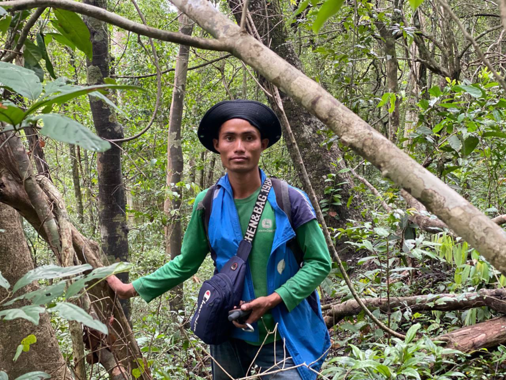
Mr Khoeun Preuk, is a 29-year-old husband and father of three, who lives in the remote village of Roveak, situated along the southern border of Lomphat Wildlife Sanctuary in Mondulkiri. Roveak is a remote and traditional village of around 700 people, and the people of Roveak Village are mainly from an Indigenous ethnic minority, group which in the case of Roveak Village is the Kraol People.
In the case of Mr Preuk, he is half Kraol and half Bunong. Kraol people are one of the smallest Indigenous groups, consisting of just a few thousand people only in the area around the Kratie and Mondulkiri provincial border. Kraol people’s way of life and culture is strongly interlinked with the forests of their surroundings. Like everyone from the village, Mr Preuk used to depend on the forests for food, medicine, and income.
‘According to my observations when I was a child, wildlife used to be very abundant in this forest, especially in the old, dense forest’ he says. ‘Between 2000 and 2008 that, I still saw animals such as Elephants, Asian Wild Dogs, Jackals, Wild Cattle, Tigers, Clouded Leopards, Leopards, and many other animals. But now a lot of that wildlife is being lost, and a lot of the big trees have been lost.’
The problems are also for the people however, not just for the biodiversity. ‘Today, some things in Roveak Village are becoming more difficult, such as the loss of forest land near the village, where people would graze their cattle, which has now has become private land, and the search for non-timber forest products has to be done far away from the village because all the resources are reduced, and many people come to find them.’
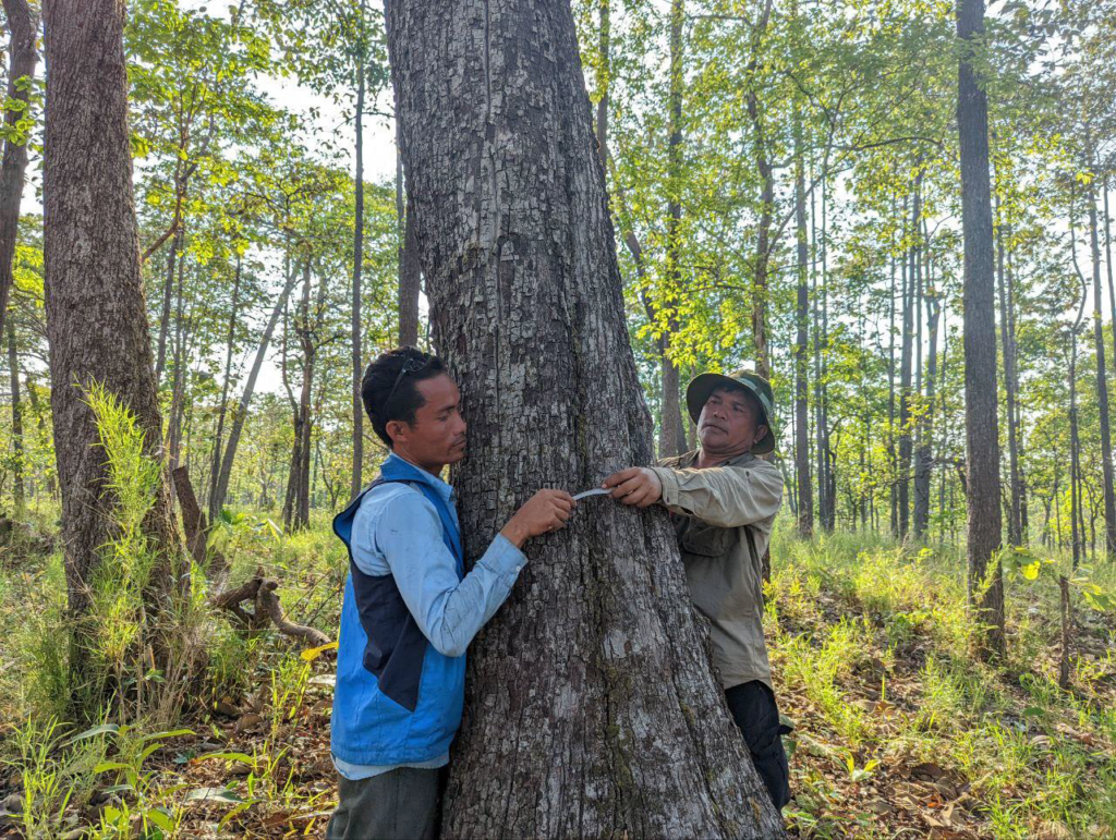
Mr Preuk was speaking to NatureLife Cambodia following the completion of vegetation plot surveys he had just conducted as part of the LWS (Lomphat Wildlife Sanctuary) REDD+ Project. REDD+ stands for: Reducing Emissions from Deforestation and forest Degradation, ‘plus’ the sustainable management of forests, and the conservation and enhancement of forest carbon stocks, and is a mechanism that supports countries’ efforts to mitigate climate change by paying them for results in reducing greenhouse gas emissions from deforestation. The LWS REDD+ Project is a joint project between NatureLife Cambodia, BirdLife International, and the Ministry of Environment initiated in 2019, that aims to generate carbon credits for sale on the voluntary market through the REDD+ mechanism. Revenue from the sale of those credits can then be used to protect the forests of Lomphat and improve local community livelihoods. A vital step of the project is to conduct vegetation plot surveys to measure and monitor the carbon stocks in the forests, as well as the biodiversity and ecosystem services they provide. By collecting data on the tree species, diameter, height, crown cover, and other parameters, the vegetation plots can help estimate the amount of carbon stored in the forest biomass and soil, and how it changes over time. The team undertook 404 vegetation plot surveys of 552 planned plots. This information is essential for reporting and verifying the emission reductions achieved by REDD+ activities, and for receiving results-based payments from donors.
Mr. Preuk had just returned from 15 days undertaking these vegetation plot surveys. An early bout of monsoonal weather had added to the difficulty of traversing quite long distances through the forest across the sanctuary, but being well-used to the conditions still found it an enjoyable and satisfying task. ‘I’m really happy to be involved in this work with NatureLife Cambodia to study the forest for the carbon credit project. I hope this project will be a success, and keep up the good work’, he told us. ‘Participating in this activity gave me a lot of knowledge, such as measuring trees, using GPS devices, knowledge of forest benefits, wildlife, and sharing experiences. Personally, I am very happy and continue to participate in the organization’s project to contribute to the protection and prevention of deforestation and wildlife and I want to encourage the other people in my village to participate too.’
Mr. Preuk’s and the rest of the teams recent efforts in late May/early June this year provided valuable contributions and data. For many parts of the LWS REDD+ Project area, remote sensing techniques occasionally provide lower carbon stock estimates for certain forest types than are actually discovered when real measurements are taken on the ground. So, working together, it’s hoped that these 404 plot surveys will go towards helping the project realise the goals of protecting the forests that are such an important part of local indigenous heritage.
